


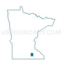
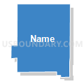
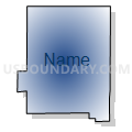
Blooming Prairie Voting District, Steele County, Minnesota
About
Outline

Summary
| Unique Area Identifier | 604548 |
| Name | Blooming Prairie Voting District |
| County | Steele County |
| State | Minnesota |
| Area (square miles) | 1.34 |
| Land Area (square miles) | 1.34 |
| Water Area (square miles) | 0.00 |
| % of Land Area | 100.00 |
| % of Water Area | 0.00 |
| Latitude of the Internal Point | 43.86839530 |
| Longtitude of the Internal Point | -93.05562180 |
Maps

Graphs
Select a template below for downloading or customizing gragh for Blooming Prairie Voting District, Steele County, Minnesota


Neighbors
Neighoring Voting District (by Name) Neighboring Voting District on the Map
- Blooming Prairie Voting District, Dodge County, MN
- Blooming Prairie Twp. Voting District, Steele County, MN
- Westfield Twp. Voting District, Dodge County, MN
Top 10 Neighboring County Subdivision (by Population) Neighboring County Subdivision on the Map
- Blooming Prairie city, Steele County, MN (1,996)
- Westfield township, Dodge County, MN (451)
- Blooming Prairie township, Steele County, MN (430)
- Blooming Prairie city, Dodge County, MN (0)